Wednesday, April 24, 2013

Mt. Cook (Aoraki) and some mountaineering history

Mt. Cook which had been hidden behind clouds the previous day- stood out clearly rising behind Lake Pukaki as we drove in from Lake Tekapo. Mt. Cook or Aoraki- named by the Maori meaning "sky piercer" is the highest mountain in New Zealand- at 12,316 ft (3,754 m). While much smaller than the Himalayas- it is just as challenging. The first 10,000 feet are a vertical ascent. That and the sustained glacial climbing, rapidly changing weather conditions, high likelihood of avalanches (we heard two just yesterday) and between 15-20 hours to the summit and back- make this climb only available to the most experienced climbers. About 250 people climb this every year- although I am not sure how many of those actually summit.

The first recorded ascent was done in 1882 by William Green (Irish), Emil Boss (Swiss) and the guide- Urich Kauffman (Swiss). The first woman to climb was Freda du Faur who's photo is below. In 1906, when visiting Christchurch from her home country of Australia to see an exhibit- she also visited Mt. Cook. It appears that she was then hooked. By 1909, she was training as a mountaineer. Only one year later- she summited Mt. Cook (in a skirt on less) on 3 December 1910- with the fastest recorded time. Her life is fascinating. Before her suicide in 1935, she published an autobiography entitled "The Conquest of Mt. Cook" which was published in 1915. I found this audio documentary about her life- http://www.abc.net.au/radionational/programs/hindsight/starlit-heights-and-winding-valleys-the-life-of/3146828

And Sir Edmond Hillary, a resident New Zealand mountaineer, reached the summit in 1958. The locals believe that his training on Mt. Cook provided him with the skills needed to summit Mt. Everest.

So- no, we won't be snapping photos from the summit while we are here. In fact, the weather has turned so much that we're stuck indoors for what may be the entire day. We did have perfect weather for the majority of the day yesterday so went on a hike through Hooker Valley- complete with three frighteningly long swing bridges (which Nate clearly is not bothered by- photo below), beautiful views of Mt. Cook, the excitement of hearing two nearby avalanches and the chance to see and hold glacial ice that broke off the glacier last week... An incredible day- I'm so thankful we arrived yesterday and not today!


Sunday, April 21, 2013

Last trek in New Zealand- Milford Trek

The Milford Track is known as one of the finest walks in the world. For 6 months of the year- it has 40 "independent trampers" a day- every day. Then there are also folks trekking on the Guided Walks tours. This is the luxury version where porters carry the food and bedding for the trampers - and the trampers are treated to comfortable beds and hot showers followed by wine and/or beer (that they didn't have to carry). In direct opposition, we sleep in separate huts located on different locations on the trail. We rarely see each other on the trail. I found this breakdown between the two options on a Guided Walks website- http://www.ultimatehikes.co.nz-

WEIGHING IT ALL UP
Going Guided--
Comfortable lodges
Comfortable beds
Drying rooms
Hot showers
Meals provided
Travel provided
Small backpacks
Knowledgable guides

Going it alone--
Basic huts
Carry your own bedding
You get wet, you stay wet!
No showers
Carry & cook your own food
Arrange your own logistics
Large backpacks

What they don't mention is the enormous cost difference. It is significantly cheaper to do the hike on "your own" (you're never on your own- there are 39 others)- than with the Guided Walks. The Guided walks are around $1900 for Milford Track while doing it independently is several hundred dollars (yes, still costly). The base cost is for buses to and from the ferry, the ferry at the start and end of the track and the huts for each night on the trail. All of the other Great Walks that we have done also had a cheaper camping option. Due to the extreme amount of rainfall in the Fiordland region of the South Island- huts are the only option.

The plus side (and there are many) to going with the Guided Walkers is that you carry a significantly lighter pack and are able to take a hot shower at the end of the day! The Independent trampers also do the Milford Sound hike in less time while the Guided Walkers having an extra day on the trail. It's a great option for someone who is unsure of their physical condition/endurance for a multi-day trek. When my knees start to go out on me- this is what I'll be doing! It's hard to even imagine how heavenly a hot shower would be after a long day on the trail. The independent trampers go days without a shower- maybe without even bothering to change socks! If Nate and I want to clean up- we have to jump in the closest safe body of water- and have! Since I've never seen the Guided Walker's huts- I can't attest to their plushness but I'm rather sure that the hikers get a bit more privacy. The Independent trampers sleep 8 or more to a room- sometimes sharing one long wood plank to sleep on. But all this being said- I wouldn't change a thing- truly. It's how it's supposed to be done... although a glass of wine in the evenings would indeed be lovely!

So back to our hike- we got off the Milford Track on 20 April. It's a four day hike with the first day being just a short hour and a half from the ferry drop off. To hike it, you must ferry across Lake Te Anau to the trailhead. Our ferry pulled out of Te Anau Downs- and took us to the start of the trail. From there we swatted at sand flies as we strapped on our packs- took a few snap-shots and started the first of our four days. The trail was beautifully manicured all the way to the hut- following the Clinton River where we saw large rainbow trout!

The following days were quite a bit longer but very doable. The total length of the hike is 33.5 miles/55 kilometers - with the only steep push being the first two hours of the third day to reach McKinnon Pass. Because of the trails popularity, we found the condition and signage on the trail as well as the size of the huts were wonderful.

It was remarkable to walk the valley floor surrounded by lichens, moss, ferns and an amazing number of waterfalls. Fiordland is one of the wettest places in the world but NZ is in the middle of a critically serious drought - so while the waterfalls were beautiful- we were told that they are only 1/30th of their normal volume. We had no rainfall at all while on the trail- so while the environment seemed amazingly lush- the rangers seemed to think that everything seemed a bit wilted from the lack of rain. The rangers also told us stories of trampers having to push trough knee-to-hip levels of water- which explains the orange trail markers. That certainly would have changed my level of enjoyment- but at least we'd be clean! :)

The birds were also amazing. We saw the ever present fantail- showing off it's spread plumage as it dances about. The New Zealand Pigeon (Maori name is Kereru). This pigeon is the world's second largest pigeon. It's hard to imagine one that's larger. We heard the Tui- with it's unique electronica call. The Weka who looks like a Kiwi but with a shorter beak and who are not nocturnal. The I was introduced to the Kea for the first time. The Kea are an alpine parrot- the only in the world. There are only about 5,000 of them- per the Kiwi Birdlife Park (www.kiwibird.co.nz) in Queenstown- a must do if you're ever in Queenstown. Nate- who can do amazing bird calls had a half hour back and forth with them before we set off on the trail on the third day. There were around 30 or more of them perched in the trees abound the hut- probably looking for some treats. They are famous for flying away with trampers boots, unzipping backpacks and getting into whatever they can. We tied our boots laces up and hung our boots from hooks outside of the hut to dissuade them from taking our boots. I was thrilled to see my stinky shoes just where I left them the next morning. We also heard the elusive Kiwi after dark- but never have seen them in the wild. We did however have a lot of time to watch them at the Kiwi Birdlife Park- that sets up a display in a darkroom to simulate evening for these nocturnal birds.

So- now that we've completed our last hike in New Zealand- I can't help but feel torn with how much we've done/seen in our two months here but also sad to not have done more. The Routeburn Track looks fantastic. Maybe I'll have the chance to come back one day...


Saturday, March 30, 2013

Arrival on the South Island of NZ!

After an amazing month on the North Island- we've arrived on the South Island.

The inter-island ferry ride was three hours- departing Wellington and arriving in Picton. The last hour was stunning views as we navigated a beautiful channel of islands. Nate talked to someone the other day that took the ferry and said that the weather was so foggy that there was no visibility - so we're counting ourselves lucky! (Photos from the ferry and of Picton below). Picton looked like a very cool town but we were already booked on a bus for some stomach turning mountain roads. A few hours later- we jumped off in Nelson.

We don't know much about Nelson other than they get the most sunny days on the South Island. We also found a beer we really like that's brewed here. Those facts alone seemed like a good enough reason to stop for a few days. After a night in the crowded but nice YHA hostel- we moved into a room that we're renting which we found on Airbnb. It's cheaper than renting our own room in the hostel and we're overdue on having our own space to rest and relax. I'm really looking forward to the next few days here before our hike in Abel Tasman National Park and our onward trip through the South Island.

Our place is super cute and comfortable with lots of sunlight. Nate's already in a deep sleep. Yep, it was time to slow down for a bit!


Friday, March 8, 2013

Great Barrier Island, NZ- March 2013

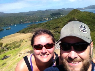
It's heaven here. The island is quiet, off the grid and beautiful. Perfect transition after spending too much time in the cities and in crowded hostels. We needed a week away- to regroup before we launch into seeing NZ. So, after a few days in Auckland- we booked a 4.5 hour ferry to the island. Upon arriving with no plan, reservations or even a map- we paid the shuttle a few bucks to take us to he closest town, Tryphena. It dropped us off in front of the market, pub and cafe. All next to one another. That's Tryphena- apparently. After chatting with the locals and realizing that there were limited affordable accommodations in "town"- we set off for a campground that was on the map. It was about a half hour walk to the campground- the walk being along a beautiful road that hugs the bay and views of green and blue waters within small coves with white sand beaches. I think of it being a scene more familiar with a postcard from the Bahamas....

As we would discover many times later- the map we were given by the shuttle driver was unclear (although presumably better than having no map, which was our previous predicament). At a fork in the road, I hailed down a local to inquire about the campground's location. He had few teeth remaining, was frail and shirtless, and someone that looked like perhaps he was a faithful meth user. "That's my campground" was the answer- "hop in and I'll give you a lift". Without even eyeing Nate's response, I quickly declined and said we'd make our own way there which of course turned into a long hike up a steep, graveled road which I was hardly prepared for- since I was still wearing my flip-flops from the ferry ride. Once we found it, we realized that not surprisingly, we were the only ones at the campground. After discussing our dilemma and my choosing our our current situation over hiking all the way back to town with our packs- we set up camp. We then set back into town to check out the Irish pub- make some friends- and perhaps drop it into conversation that we were at the camp at the end of the road either searching for a confirmation that it was fine--- or just to let someone know where we were (assuming that it would upset our folks to start an email with "just so you know...." We didn't end up bringing it up at the pub. After getting back to camp, he owner drove down into the field to collect the night's payment. Immediately, my concerns over our safety were diminished since he brought us a large bag of a dozen or so apples, zucchini and squash. We slept in peace, alone, under a star-filled field happy to e on the island. Still, admittedly, I felt relieved to wake up in the morning and pack up to go on our way.

That morning, we loaded our packs up again with all our food, gear, clothes and a few apples- preparing for a hot 2 hour walk to the other side of the island - to a beach town called Medland. It wasn't but a few minutes down the road that we got an offer for a lift- and a recommendation on where to stand to get a lift to Medland. Flagging down a ride in the location that had been recommended- Joe who works at the cafe we had been o the day before (and was the one to break the news to me that there's no bus on the island and no need since everyone hitches) pulled over and asked us where we were off to. No problem he said. He needed to do a quick errand but if we were still there on his return- we could jump in. And we were- so we did. A windy road up into and over the hills - we were thrilled when he dropped us of at the top of the long, steep hill where a rustic hostel stood with chickens and 11 chicks running about. Perfect! It was a beautiful beach with not a soul on it other than Nate and I.

The above was my journal entry on the second day after arrival. I was reminded of it because we are now back at the same hostel 5 days later after having hiked - or hitch-hiked across much of the island. The folks here are off-the-landers. Rain and stream water are captured here. The are only three general stores on the island that I am aware of-- most folks grown their own food or order shipments from the Auckland grocery stores which are delivered on the ferry for a $30 service fee.

We spent more time doing "tramping" than "walking"-- tramping being the more difficult of the two-- but we saw and experienced such amazing beauty as we zig-zagged our way across the island.

For my own sake of remembering:
Day one: arrived by ferry around noon, caught a local shuttle to Tryphena, stayed at sketchy campground west of Tryphena.

Day two: Hitchhiked from Typhena to Medlands - stayed at the Medlands Backpacker

Day three: Hitched to Claris, walked 2 hours to Hot Springs and then tramped through rough terrain for 2 hours to Green Camp.

Day four: Tramped for 6 hours through rough terrain to campground near Port Fitzroy.

Day 5: spent the day in Port Fitzroy and local nature conservancy. Hitched across the island to Whangapoua Creek campground.

Day 5: Hiked the Harataonga /Okiwi Coastal track or 4 hours to Harataonga Beach

Day 6: Hiked up the campground road to the main road- and hitched a ride with the around-the-world boaters.. Grabbed lunch in Claris- and then hitched to Medlands.

Day 7/last day: hitched from main road to Tryphena by a nice guy with a failing car- then walked an hour to ferry


Friday, February 15, 2013

The Overland Track- Tasmania

Day 1-

I'm writing this at 6:40am because the hut is getting loud with folks starting their day. My back is tight as I lay in bed.

Yesterday's trek was to be the most difficult. And I'm sure glad to hear that because the word "brutal" kept circling in my head. Our bus from Lanceston picked us around 8 yesterday morning. After a few stops, we arrived at the Cradle Mtn Visitors Center to collect our permits. There was no water there so we shuttled to Dove Lake an filled up our water reserves and signed into the logbook. It was just around then that the weather changed. The overcast day turned into sideways rain and powerful wind. We climbed upwards all day on either man made wooden boardwalk stairs or up rocks. Once even having to pull ourselves up with a chain- which Im so thankful was there. The wind blew so hard that if it stopped- I'd fly off in the wrong direction because of overcompensating as I pushed against the wind. We were soaked and I was soon muddy as my right leg sank into a muddy bog. What's unfortunate is that at rare points we couLd see just how beautiful it was around us- and then the low rain clouds would sweep in again. We were the last ones to arrive at the hut- which is still confusing since no one passed us. The only thing I can think is that we took a side trail to pass Wombat Lake. We must have been passed then. The rain and blustery winds continued through the night. It sounds like the rain stopped but the wind is still howling. We built in extra days for this trek so we're not rushed. Knowing ahead that yesterday was a steep climb- we planned on only going a few hours today to the next hut. I can't wait to drink tea, read and settle in. And get out of that wind!!!

Day 2-

Made it to Windmere Hut around 3. It was a beautiful day- a bit rainy and cold at times but otherwise gorgeous blue skies. I knew that today would make up for yesterday's pain- when a full rainbow graced us just beyond the hut. Today was a 3 hour hike and we did an hour side trip to see Lake Will. Thankfully, we could leave our bags behind with hopes that the the Karawong crow wouldn't get into our packs and eat our food. Apparently, they are quite good with zippers. Tomorrow is a 7 hour hike. Not as tough as the first day but apparently with quite a few steep climbs.

Some others at the hut are still feeling the pain from yesterday's hike. While most of me feels fine - my back feels like it could spasm at any moment. If a chiropractor didn't cost a life savings here- along with everything else- I would certainly go. We are trying to eat our heavy foods first but I'm not sure it will make our packs noticeably lighter.

Looking forward to a nice meal and lots of sleep before tomorrow's trek. Even considering a clean set of clothes for it ;)

Day 3- 10 miles/6.5 hours from Windmere Hut to Pelion Hut

Made it to Pelion Hut. It was our longest day- and while not as strategic as our first day- it did require a lot if attention to maneuver past long, deep bogs and a maze of roots. My feet are almost unusable at this point. So unbelievably sore that I can hardly walk on them. Nate's limping around too. I hope we recover by tomorrow- which is a steep ascent up a mountain and then down the other side. But, it is still a much shorter day.

What was incredible about today was that we left the plains that we were in yesterday an entered a rainforest. Lots of ferns and even a tree that looks at the trunk like a redwood.

We're pretty beat but being at the hut is great. Today was amazing- at times I couldn't even believe how beautiful the countryside was. I see now why the couple that is going the same speed as us- comes back every year. It's without a doubt, the most beautiful place that I've ever been.

Day 4- 4 hours from Pelion Hut to Kia Ora Hut

Today was a rather short day to get up and over Pelion Gap. It was a pretty steady climb up to the Gap but then a relaxed decline through valleys and forest. We are now halfway through the Overland Track. The hard parts are all behind us and I feel really good!

We're at Kia Ora Hut now. A much smaller hut by a long shot than Pelion Hut which was first class (picture below). This one is much more like the hut we stayed at our first night which is fine but I got spoiled by the space we had at the last one. The flies got in- these aren't the flies that Americans know. These are big and annoyingly loud. They look like a bee on steroids and they are always in your face. They make it impossible to take a break while hiking. As soon as you stop- they find you and try to land on your face. Enough people are coming in and out- that there's no way to avoid having them come in. Nate is doing his best to trap them in between the window and the screen. He's already got three.

Tomorrow, we make our way to the Windy Ridge Hut. It's about 4.5 hours but there's also two side treks to waterfalls that we want to do- which will add 2 hours. Since today was a short day, I slept in and we didn't leave till 10. Tomorrow, we'll have to get up with the masses.

We've decided to add an extra day and instead of taking the ferry (which is a rediculous cost of $40 each!)- that we'll walk instead. Our shuttle doesn't come until 8 so we'll walk further on Thursday to make sure that we have plenty of time on Friday to make it back to the Lake St. Clair visitors center to confirm our hostel reservation in Hobart and maybe even grab a pint.

Day 5- I had to look which day it is. I am starting to lose track! Now at Windy Ridge/Burt Nichols Hut.

All the uphill is over! Although, I swear I thought that yesterday as well. Today wasn't as much as a climb as yesterday but the days on the track are starting to take a toll on my knees and ankles. Getting on top of Du Cane Gap (1070 m) felt great. We had worked our way through a fairy tale rain forest on the climb which helped ease the ascent. Thick mosses, ferns, fungi and more King Billy Pines (the ones that look like redwoods). The couple that have done this climb more than 30 times said that the descent was the driest and safest that they've ever seen it. I can't imagine scrambling down all those root wads, mud, and big drops if it was wet. They said it's extremely dangerous- and I would have said that even when it was dry. But are ankles are intact, although worked.

We also saw some truly spectacular water falls today. They were side trips off the track but so worth it. I have photos on my camera but didn't take any with my phone which I'm using to write this.

Tonight will be our last night with some of our companions. They'll be catching the ferry tomorrow to the visitors center and we'll continue to the next hut. We booked to leave on Saturday because it had the least number of passes reserved (11). The maximum number of passes for this trail is 24. We've become rather close with the group. It'd be hard not to. We all share a small kitchen each day as well as sleep in the same room (except for a few of the huts that have separate dorm rooms). There's a guy about our age from Sydney- Michael. Another guy and only other American here from Philly- Jason. The older couple that are local- Fred and Lynn. There are three young guys from Germany who have an unending supply of energy. And a very nice French-Polynesian couple. They all have really shaped this trip. Maybe tonight I'll see if anyone is interested in a group photo.

Day 6- camped at the beach on Lake St. Clair next to Echo Point Hut.

The hut is TINY- it only sleeps 8 (four beds) and seems to have no limit to how many mosquitos can stay there. So, we set up our tent next to the lake. We haven't used it yet on this hike and have carried it all this way. There also is no rain water collection tank here which was surprising. Luckily, we had enough fuel for yet another couscous meal (we alternate rice noodles with couscous and are sick of them both). All we can talk about is the pizza and beer we're going to get. It completely reminds me of when Tami and I were nearing the end of our Nepali Coast hike in Kauai three years ago. We couldn't wait for beer and pizza- even going in straight off the trail- realizing soon after how smelly we were.

The trail today was hardly easy. This is a section of the trail that is not used often. Most folks are already out of their hot shower after having taken the ferry from the Narcissus Hut. Instead, we decided to keep going and had to get past broken bridges, washed out track and a number of wash-outs with downed trees. I had a breaking point where I almost suggested turning around and taking the ferry but we had come too far. Today was around 10 miles I think. Tomorrow will be closer to 6. We'll get there around noon and catch our bus at 8. I'm hoping that there is a laundry facility and a place to shower- but priority #1 is pizza and a beer.

There's quite a few people here who all are catching the same bus and going to try and stay at our hostel- Michael from Sydney who did the track with us and an American and a Canadian girl who have been walking together. Everyone is tired but in good spirits as we are so close to being done. Jason who also was hiking from our group looks faded. He walked right by us with a pained expression on his face... I'm thinking now it's because I told him that it was going to be easy today. Oops - I thought it would be with no steep ascents but the trail was in such bad shape. We're all just wiped out. I feel good (in spirit)- I'm really, really glad that we did it. Unlike the US- there is no road that cuts into the park so that visitors can come in and see the main attractions. The only way to see this area is to trek in as we've done. Or have almost done - 3 more hours...

Day 7- Lake St. Clair Visitors Center

We made it! It took almost exactly three hours and we are now sitting amongst very clean, good smelling visitors as we drink our pints and order over priced food- but it's worth it! We just saw Jason and Michael come off the trail. And saw Bijorn (one of the fit Germans) as we arrived. It was nice to see a friend to welcome us in. It's pretty funny to now be sitting in a chair and listening to cheesy music while drinking a beer. My sore legs and feet are now the only thing to remind me that the last 6 days really did happen.


Monday, February 4, 2013

Australia- 05FEB13

Somehow we're already in our third week in Australia-- and it's been incredible. Before we arrived, the news was showing massive fires and extreme heat. Yet, when we arrived to Perth (which has been 107 the week before)- it was raining and cool. It's been comfortable temps ever since.

We're now in Melbourne- leaving for Tasmania later today. We'll be there for two weeks with one week to do the Overland Trek. Since arriving in Perth mid-January-- we spent a week and a half on the West coast with Beau, Martha and Maya. After spending a few days exploring Perth, Fremantle (Freo) and their neighborhood in Cottesloe-- we traveled south to the wine region. We rented a very cute house with Beau and Martha in Denmark (picture attached)- where Nate and I saw our first kangaroos gathering in the nearby field at dusk. We wine tasted, explored beautiful beaches and cooked amazing food while catching up about their lives in Australia.

From there we drove north west along the coast towards Margaret River. On the way we stopped for some pictures and snacks at Cape Leewin- the most southwest point in Australia. Attached are a few pics with the Good Luck Bus- given to me by my nephew. He's following the pictures and marking the places on his world map. Nate and I are coming to believe that the bus really is good luck.

We spent a few days in Margaret River (specifically Prevelly, just west of Margaret River) including a perfect 3rd Anniversary spent swimming in the ocean and drinking wine from a vineyard we stopped by on one of our tastings. On our walk from Prevelly back to Margaret River to catch our bus- we saw a large number of kangaroos gathered next to the walkway- cooling themselves in the shade. It was a nice break from the hike to town so we hung out in the shade watching them-- watch us. I don't seem to have any photos on my phone (which is what I'm writing this on) but Nate has some uploaded to his Facebook page.

Next we flew southeast to Adelaide. It was very odd not to be heading back home and to work after two weeks of traveling! Reality is hitting-- and its amazing. My friend Margaret whom I had met years ago in Arcata when working for Stillwater Sciences is now doing her post doc in Adelaide on water resource availability. She and her mate (trying my best to toss in "mate" so that eventually it will come naturally- as it does with the Aussies) Sam picked us up from the airport and gave us a great tour of the area and the hills above town- which is where we saw our first koalas. We both remember clearly Sam saying that we'll look back and laugh at the photos we took since soon enough we'd see so many more- and much closer. He, of course, was right. But, it was a great moment of realizing that we were in a different area and thankfully still in wine country- which is what we explored with them the following day. The following day we wandered for hours around Adelaide. My parents had lived close by in Queenscliff right before I was born and told me how much they loved the city. We did too-- and while we could have spent another day there easily, we found an amazing deal to return a car to Melbourne and grabbed it! We had 5 days to drive the Great Ocean Road before returning the car.

The Great Ocean Road is breathtaking. Between the views and our first experience driving on the "wrong" side of the road-- we felt full of adventure! The scenery is full of stunning limestone formations, gorgeous variations of blue ocean, rainbows, and cute towns. We arrived late to Nelson where we had been told that there was a wonderful park with free camping. I am sure that there was but we never found it. Instead we pulled into an RV park after hours and slept in the car. While it wasn't our best night sleep, we were thankful that we didn't camp- since it rained all night. Next day it was my turn at driving on the wrong side. I drove so far left that I'm surprised that the left side of the car wasn't scraped by trees! Finally I got the hang of it.... and we sped up to keep up with traffic. We drove to Apollo Bay- a cute town with a bizarre hostel that we ended up in-- but it was affordable and we had our own room in a shared house. It really didn't matter where we slept- we were so tired from not sleeping the night before and getting on the road so early as to avoid having to pay. The next day is where we began to see so many of the views that we had read about. It seemed every few hundred kilometers, there was another breathtaking reason to stop and pull out the camera. I've uploaded some of those photos-- including the koala that we met near Apollo Bay.

The following day- we drove to Queenscliff to check out the town which is on the western spit of the Port Phillip Bay. My folks lived there in the mid-70s while my dad attended school at the military base there. We knew that there was camping there--- and I had a rough idea of where my folks house was. We were surprised to find that the town was packed with people- watching an old car show. Maybe 100 or more old cars where parked or driving up and down the Main Street. Needless to say, camping was booked and probably had been or weeks. So, we tracked down their old house- a very dark picture is attached. It is amazing. A multi-story house right on the beach-- with dune trails hidden amongst the trees. I have to say, it wouldn't have been a bad place to have lived. After day-dreaming there for a bit-- we headed out of town to a camping area we had seen in Ocean Grove which seemed to have a good food selection. $40 for a camping spot though! Ouch. But it seemed like our only option unless we wanted to sleep in the car again- which I didn't. It was the last night of "high season" so now camping should be cheaper as Australia starts to move out of their high summer season.

Since then, we've been in Melbourne, taking in the sights of the city and enjoying our own room at the Greenhouse hostel, which is right downtown We haven't had much time to catch up on email or research our next destinations. So, it's nice to have free wifi- which is very hard to find in Australia.

Next up- Tasmania! It seems a bit cheaper there. Beer is bout $10 a pint here and it's hard to find a meal under $10... We knew Australia would be the most expensive place we'd be-- and it will be a sweet relief to spend less money in New Zealand and beyond.

If you're still with me and my rambling update on places we've been - thanks. I guess this is as much for me down the road as for folks who are interested in what we're doing. I'm already starting to get places and accommodations confused!

Thank you to Beau, Martha, Margaret and Sam for hosting us and showing us your lives and cities!